Stone & Sky
Enter the Stone & Sky experience
An artistic study of Newgrange, not a survey or illumination forecast
Shop Sky over Stone Newgrange collection. Opens in a new tab.
Fáilte · Welcome
Ireland’s Neolithic and Bronze Age monuments, and the sky they face. Cloch agus spéir
Rock-art example: SMR MA097-006001-, townland Boheh, Co. Mayo. The National Monuments Service web notes call it “The Boheh stone”.
589 Republic monuments of the types on this map are not mapped because the NMS open data gives them no coordinates (ITM 0,0).
Twenty letters (feda) in four groups (aicmí), with the Latin transliteration under each one.
Scores to the right of the stem.
Scores to the left of the stem.
Scores across the stem.
Notches on the stem.
Writing from about the 5th to 7th centuries AD, thousands of years after the tombs.
The surviving ogham stones belong to about the 5th to 7th centuries AD (Ogham in 3D; Stifter 2020). Passage tombs on this site are mostly 3300–2900 BC (NMS scope notes). Fern is written F in the older transliteration and V in the modern one. H, NG and Z are medieval values; their original sounds are uncertain. Scores: Aicme Beithe to the right of the stem, Aicme hÚatha to the left, Aicme Muine across it, Aicme Ailme as notches (Stifter 2020). This is a schematic, not a rubbing. Ogham in 3D — its images are licensed per institution, so none are shown here. Stifter 2020.
By Garry Lohan · Ag faire ar an spéir (Watching the sky)
The site stays free. If you want a shirt, shop the tees.
Light in the chamber: Newgrange at the winter solstice
Pick a morning and drag the time slider, or drag across the chart. The Sun’s position is computed for Newgrange. Day zero is the December solstice for the relevant year, from Astronomy Engine, not a fixed 21 December. The gold window is the zone of sky from which direct sunlight was actually photographed in the chamber in 2020–21: the 53 positions measured in the NMS 2024 research report, shown as dots. When the Sun is inside that window, the beam lights the chamber.
Enter the Stone & Sky experience
An artistic study of Newgrange, not a survey or illumination forecast
Shop Sky over Stone Newgrange collection. Opens in a new tab.
One light window is used for Today and for Light this week. National Monuments Service (2024), Winter Solstice Phenomenon at Newgrange: Research Report (F. Prendergast) gives three figures. The key findings (section 2) say the limits are “currently being about 20 days either side of the notional date of the winter solstice on 21 December.” Table 9 says direct sunlight on 8 January 2021 “has effectively ended by this date, 19 days after the notional date of the winter solstice on 21 December 2020,” and that it “will also enter the burial chamber 19 days before solstice, albeit minimally.” Chapter 10 says “direct light from the rising Sun which can only penetrate the chamber for less than 20 minutes for about 18 days either side of the date of the winter solstice.” Today and Light this week follow that chapter 10 figure, 18 calendar days, so they open and close together. Counted back from 21 December, 20, 19 and 18 days are 1, 2 and 3 December, so light may enter from about 1–3 December. The window used here opens on 3 December when the solstice falls on 21 December. Direct sunlight was photographed in the chamber from 12 December 2020 to 8 January 2021.
December solstice
Next solstice-morning sunrise
The solstice instant is Astronomy Engine’s Seasons(year).dec_solstice, shown in Irish time. In December, Irish time is GMT. Flat sunrise is SearchRiseSet on a sea-level horizon. Real horizon is the Sun’s upper edge on the Copernicus 30 m skyline. The five mornings are the ones the Newgrange Winter Solstice Lottery calls “the mornings of the winter solstice (19–23 December each year)”. This card stays on those mornings through 23 December, after the solstice instant as well.
No 2026 livestream address is published yet. On 15 October 2026 the OPW said a livestream will take place on Monday 21 December 2026 across OPW platforms, and that further details will be announced in the coming weeks. Recent livestream announcements were published on 1 December 2023, 9 December 2024 (the link on 17 December) and 3 December 2025. This page will add a 2026 address only after it is checked.
Until then, the official pages are:
In 2025 the OPW said RTÉ would broadcast from 8.40am on 21 December (OPW press release, 3 December 2025). The 2026 note that a stream will happen, without an address: OPW, 15 October 2026.
Schematic, not to scale in height. The passage is about 19 m long and the chamber floor sits about 2 m above the entrance, so the light comes in through the roof-box above the door, not through the doorway (O’Kelly 1982; NMS 2024). O’Kelly saw the beam on 21 Dec 1969 from 8.58 to 9.15 GMT, 17 minutes in all. The “Neolithic tilt” button uses the Earth’s larger tilt c. 3200 BC, when the solstice Sun rose further south; Ray (1989) showed that the beam then reached the back of the chamber.
The great mound at the west end of Brú na Bóinne, SMR ME019-030001-. Townland Knowth, Cnóbha. Every figure below is from the National Monuments Service text already on this site, from Heritage Ireland or World Heritage Ireland, or from a published archaeological account. Newgrange is unchanged.
Shop Sky over Stone Knowth collection. Opens in a new tab.
Left and Right arrow keys move between topics.
The National Monuments Service description calls this Tomb 1C: a great kerbed mound, and the focus of a passage-tomb cemetery at the highest point of the bend of the Boyne. It stands at the west end of a shale ridge. The Boyne, coming from the west, is turned south by the shale and then east and north, around the townlands of Knowth, Newgrange and Dowth. Each townland has one extraordinarily large passage-tomb mound.
The mound is subcircular: 95 m north–south, 80 m east–west, and 10 m high. A circuit of 127 contiguous kerbstones, including a few gaps, is numbered clockwise from the junction with Tomb 16 at the north-east. The kerb incurves at the east and west, towards the entrances of two passage tombs set back to back. Their chambers are only about 5 m apart at the centre.
At least 19 smaller passage tombs cluster around the great mound on the south, west and east. The same description records another, ME019-030078-, somewhere in the grounds of Knowth House to the north-east. Satellite tombs are largely absent east-south of the great mound, where later agriculture has removed almost all the archaeological material. A Heritage Ireland education pack counts the complex as one large mound, Site 1, with eighteen smaller mounds. This page keeps the National Monuments Service count.
Knowth, Newgrange and Dowth are the three great mounds of the World Heritage property. The 2017 management plan records that the property was inscribed by the World Heritage Committee in December 1993, and that these three sites are National Monuments in State ownership. The Knowth group on the official inventory has 30 monuments, from the Neolithic through to the Anglo-Norman period and later. UNESCO list 659.
Visits to Knowth start at the Brú na Bóinne Visitor Centre. Heritage Ireland says access is by guided tour and that pre-booking is essential. Show Knowth on the map. All other monuments as a list.
Sources: National Monuments Service description of ME019-030001- on this site, citing Eogan and Cleary 2017. Heritage Ireland education pack. Brú na Bóinne Management Plan 2017. Heritage Ireland, visitor centre.
Heritage Ireland dates the passage tombs of Knowth, Newgrange and Dowth to circa 3200 BC. For Knowth itself the National Monuments Service is more specific. The description says the central mound was built and used over three centuries, about 3200 to about 2900 BC, and that it was not the first structure, or even the first tomb, on this spot (Eogan and Cleary 2017, p. 44).
The same description, citing Eogan and Cleary 2017, p. 49, sets out three phases. Tomb 1A was a passage tomb that was taken down to make room, and to provide material, for Tomb 1B: the east and west chambers, with short passages, and a stabilising cairn 38 m across north–south. After an interval of unknown length, thought not to have been very long, the passages were lengthened out to a new kerb and the mound of sods, clay and stone was added. That mound is Tomb 1C.
Tomb 16 was built into the great mound, and the kerb was straightened so as to avoid Tomb 13 on the north. Those two tombs at least are earlier than Tomb 1C. The education pack says some of the smaller tombs predate the large one, and that passage tombs in Brú na Bóinne were not all built at once: it describes four phases from about 3400 BC to about 2800 BC. That span is for the tombs of the area, not a radiocarbon result for one Knowth phase.
Almost all the structural stones are greywacke, and they did not come from the ground under the mound. The description gives a possible source at Clogher Head, Co. Louth. Quartz, used in the finishing, may have come from the Dublin and Wicklow mountains. Granite may have come from the Mournes. Those are the possibilities the record states, not proven quarry sites.
Sources: Heritage Ireland. National Monuments Service description of ME019-030001-, citing Eogan and Cleary 2017. Heritage Ireland education pack.
Two tombs share the mound. They do not join. The National Monuments Service says the chambers are about 5 m apart, and the education pack says the same. The entrances are on the east and the west. The education pack says the tombs face approximately east and west. Surveyed outward bearings, and the question of an equinox alignment, are in Sun through the year, labelled Open question.
The eastern tomb has a long passage and a chamber with three side recesses. The roof is corbelled, in a beehive shape. The education pack says the passage and chamber together would originally have been over 40 m, and that the capstone of the chamber roof is 6 m above the floor. Each of the three recesses held a basin stone, or shaped stones, for the remains of the dead.
The western tomb would originally have been over 34 m in total length. Its passage bends to the right about three quarters of the way in. Just after the bend is a sill-stone, and the passage then narrows to 40 cm before widening into a rectangular chamber about 2 m high. The chamber is roofed with a stone about 2 m long. A basin stone now lying in the passage would, the education pack says, originally have been in the chamber.
Colin Renfrew’s foreword to George Eogan’s 1986 book describes the finding of these passages: the western one on 11 July 1967, and the eastern one on 30 July 1968. Eogan entered the eastern chamber on 1 August 1968 and found the carved stone basin still in it. Around the entrances, the education pack notes settings of quartz, granite and banded stones.
Sources: National Monuments Service description of ME019-030001-. Heritage Ireland education pack. Colin Renfrew, editor’s foreword to George Eogan, Knowth and the passage-tombs of Ireland (Thames & Hudson, 1986), as given at knowth.com.
The published description of Eogan’s 1986 book says the central mound yielded more than a quarter of the engraved art from the whole of Neolithic Europe. That is the book’s own claim for Knowth. It is not a sentence from the UNESCO listing.
World Heritage Ireland’s art note counts more than 300 decorated stones in the great tombs of Knowth, and calls that the greatest concentration of megalithic art in Europe. The Heritage Ireland art education pack counts over 380 known decorated stones at Knowth, 116 at Newgrange and 38 at Dowth. The two counts are both published; this page does not choose between them. The same sources say the great monuments of Brú na Bóinne hold around 60% of Western European Neolithic art (World Heritage Ireland) and around 60% of Western European passage-tomb art (the education pack).
The art is geometric. World Heritage Ireland names spirals, lozenges, chevrons, triangles, and arrangements of parallel lines and arcs, carved at a large scale. The education pack adds circles, zig-zags and snake-like forms, picked or incised with stone tools of flint or quartz. Some of the stronger designs are on the orthostats in the passages, on the way to the chambers.
In the right-hand recess of the eastern tomb is a granite basin, carved inside and outside. World Heritage Ireland says the basin stones held the cremated bones and ashes of the dead, and calls this basin one of the great treasures of Knowth. On the floor between the jambstones of that same recess, the excavators found a flint macehead. The note says it is carved so finely that it reads as a ceremonial object. The education pack also records more than 200 individuals from the Knowth excavations, some cremated and some not, with stone balls, pendants and antler pins among the objects.
Sources: published description of Eogan 1986, knowth.com. World Heritage Ireland, Art at Knowth. Heritage Ireland education pack.
The National Monuments Service records excavation E00070 at Knowth from 1962 to 2000, followed by conservation. The description says the mound had drawn little antiquarian attention, because unlike Newgrange and Dowth it had no open caves (Eogan and Cleary 2017, pp. 12–18).
Professor George Eogan directed the work. Heritage Ireland says the Knowth excavations began in 1962 and lasted nearly forty years. A 2022 Heritage Ireland essay says that when the work started the site was one large grass-covered mound, plus faint traces of a three-week excavation directed by R. A. S. Macalister in 1941, and that Eogan’s seasons then ran every summer for over 35 years. Renfrew’s foreword says the early seasons were given to the smaller tombs around the great mound, before the two passages in the mound were found in 1967 and 1968.
The 2017 management plan says the Knowth excavation began as research and later turned to presenting the monument. It cites Eogan 1974, 1977, 1984 and 1986, and Eogan and Roche 1994 and 1997, and says the material runs from the Neolithic to the 17th century AD. The Royal Irish Academy published the excavation in a series. The plan names later volumes on the early medieval animal bone (McCormick and Murray 2007), the historic hinterland (Byrne et al. 2008) and the first and second millennia AD (Eogan 2012). Kerri Cleary coordinated the 2017 volume on the great mound, Excavations at Knowth 6.
Downslope from the main passage tomb, an earthwork complex was investigated in 2002–2004. The management plan says Stout and Stout (2008) interpret it as an early medieval secular cemetery. That is a separate site from Tomb 1.
Sources: National Monuments Service description of ME019-030001-. Heritage Ireland education pack. Heritage Ireland ezine, issue 17, 2022. Renfrew’s foreword to Eogan 1986, knowth.com. Brú na Bóinne Management Plan 2017.
The east and west chambers are only about 5 m apart, in the middle of a mound 80 to 95 m across. The tombs do not connect.
National Monuments Service, ME019-030001-. Education pack: about 5 m between them.
The kerb is numbered clockwise from where it meets Tomb 16, at the north-east. A few gaps are included in the count of 127.
National Monuments Service, ME019-030001-.
At least 19 smaller passage tombs stand around the great mound, with another recorded in the grounds of Knowth House. The education pack counts eighteen smaller mounds.
National Monuments Service. Heritage Ireland education pack.
Tomb 1A was dismantled. Tomb 1B was the two chambers, short passages and a cairn 38 m across. Tomb 1C lengthened the passages and raised the mound we see, used from about 3200 to about 2900 BC.
National Monuments Service, citing Eogan and Cleary 2017, pp. 44 and 49.
The eastern passage and chamber together would originally have been over 40 m, with the capstone 6 m above the floor. The western tomb would originally have been over 34 m, narrowing to a 40 cm gap.
The published description of Eogan’s 1986 book says Knowth 1 yielded more than a quarter of the engraved art from Neolithic Europe. World Heritage Ireland counts more than 300 decorated stones here. The education pack counts over 380.
Eogan 1986, book description. Art at Knowth. Education pack.
Both come from the right-hand recess of the eastern tomb. The basin is granite, carved inside and out. The macehead was on the floor between the jambstones.
The western passage was found on 11 July 1967. The eastern passage was found on 30 July 1968, and Eogan entered that chamber on 1 August.
Colin Renfrew, foreword to Eogan 1986, knowth.com.
Excavation E00070 ran from 1962 to 2000. Before that, R. A. S. Macalister directed a three-week excavation in 1941. Eogan’s seasons then ran each summer for over 35 years.
National Monuments Service. Heritage Ireland ezine 17 (2022).
The structural stones are mostly greywacke. A possible source is Clogher Head, Co. Louth. Quartz may be from Dublin or Wicklow, and granite from the Mournes.
National Monuments Service, ME019-030001-.
The education pack says the Knowth excavations found the remains of more than 200 individuals. Cremation was the usual rite, and some of the remains were not burnt.
In 2002–2004 an earthwork below the main tomb was excavated. Stout and Stout (2008) read it as an early medieval secular cemetery. It is not part of Tomb 1.
Management plan 2017, citing Stout and Stout 2008.
The chart is the computed sunrise and sunset at the SMR point already in this site’s data: 53.70122° N, 6.4914° W (site/data/sites.json). Show Knowth on the map.
Working out the Sun for this year…
| Event | Sunrise | Sunset |
|---|---|---|
| Working out the year… | ||
The dashed lines are surveyed bearings of the passages, looking out. They are not a claim that an alignment was intended, and they are not marked as proven.
Brennan (1983), after observations in 1980, treated the eastern and western passages as equinox sunrise and sunset. Eogan’s 1986 book argues that the tombs were very likely used for ceremonies at the spring and autumn equinox. Prendergast & Ray measured the axes with a gyro-theodolite and reported that they are not those equinox directions. Their outward azimuths, the altitudes they used, and the declinations and dates they give are in the table. Those dates are theirs. This chart does not recompute them.
| Passage | Azimuth out | Altitude they used | Their solar declination | Their dates |
|---|---|---|---|---|
| Eastern | 85° 08′ | 0° (slope of the passage floor) | +2° 12′ | 26 March, 16 September |
| Western, outer | 258° 34′ | +1° 03′ | −6° 12′ | 4 March, 9 October |
| Western, inner | 278° 14′ | +1° 00′ | +5° 18′ | 3 April, 8 September |
Source: Prendergast & Ray, Alignment of the Western and Eastern Passage Tombs at Knowth Tomb 1. The SMR description on this site, quoting Eogan & Cleary 2017, says the kerb incurves at the east and west entrances of two back-to-back passages. Their survey station (N 53° 42′ 04″, W 6° 29′ 26″, elevation 78 m) is not the SMR point used for the curves. The chart uses the SMR point. Eogan’s equinox argument is in the 1986 book, foreword summary at knowth.com.
The same card in Claims vs evidence keeps its existing verdict. This section does not replace it.
Flat horizon, no refraction. Each day’s declination is Astronomy Engine’s equator-of-date Sun at 12:00 UTC (the same Equator call the Newgrange chart uses). The azimuth is PAAstro.azFor at geometric altitude 0° (site/js/astro.js). Bennett refraction is not applied, and the horizon altitude is 0°, not the Copernicus skyline on the map card. Passage height, trees and buildings are not in the curves. Azimuths are degrees clockwise from true north, for the calendar year on your clock. One decimal place is the model, not a survey.
The great mound, SMR ME020-017----. Townland Dowth, Dubhadh. This site’s claims card calls the same record Dowth (South), because the winter-sunset question is about the south tomb inside the mound. The record itself is the mound, and it covers two tombs. Newgrange is unchanged.
Shop Sky over Stone Dowth collection. Opens in a new tab.
Left and Right arrow keys move between topics.
The Archaeological Inventory of County Meath (1987), in the National Monuments Service text on this site, describes a kerbed mound 85 m in diameter and 15 m high. It is comparable in original size with Newgrange and Knowth. The inventory says it is not as well preserved, and that much of the material on the west was removed at various times.
The mound covers two passage tombs, both opening on the west side. The north tomb is cruciform, with an annexe. The south tomb has a single recess. A souterrain, ME020-017001-, was built into the mound. Kerbstones and structural stones in both tombs carry megalithic art.
Dowth is the third of the great mounds in the World Heritage property inscribed in December 1993. The 2017 management plan says the Dowth group resembles Newgrange and also has medieval evidence, including a church and a castle. Knowth, Newgrange and Dowth are National Monuments in State ownership.
Heritage Ireland says visitors can see the exterior from the N51, and that Dowth is not on the visitor-centre shuttle. The same note asks that monuments on private land not be visited without the owner’s permission. Show Dowth on the map. All other monuments as a list.
Sources: National Monuments Service description of ME020-017----, from the Archaeological Inventory of County Meath (1987), revised text uploaded 10 July 2007. Brú na Bóinne Management Plan 2017. Heritage Ireland education pack (access). UNESCO list 659.
No separate radiocarbon sequence for Dowth is quoted on this page. Heritage Ireland dates the three great passage tombs, Knowth, Newgrange and Dowth, to circa 3200 BC. The education pack says Dowth, like the others, was built over 5,000 years ago, and that passage tombs in Brú na Bóinne fall in four phases from about 3400 BC to about 2800 BC. That span is for the tombs of the area.
The Knowth sequence of about 3200 to about 2900 BC is not copied onto Dowth here. It belongs to the Knowth mound in the National Monuments Service description.
Sources: Heritage Ireland, visitor centre. Heritage Ireland education pack.
Both tombs open on the west side of the mound, within 25 m of each other. The inventory and the education pack measure them differently, and both figures are kept.
The inventory gives the length of each tomb. The north tomb is 12.5 m long and cruciform. An annexe of two chambers opens off the south recess, and a reconstructed stone basin lies in the centre of the chamber. The south tomb is 8.25 m long: a short passage to a sub-circular chamber, with one recess on the south-east side.
The education pack gives the passages as they are now. The north passage is 8.2 m long and is divided by three sill-stones. It leads to a cruciform chamber with three recesses and a corbelled roof 3 m high. A stone basin on the chamber floor is 1.4 m by 1 m. The four stones that define the chamber are almost 3 m high. Off the right-hand recess is an annexe with two further chambers. The south tomb has a passage 3.3 m long into an almost circular chamber with one recess, separated from the chamber by a sill-stone. The pack says the chambers are as large as those at Newgrange and Knowth, and that they contain some of the biggest stones at the monuments.
The south chamber’s roof is modern concrete. The education pack says the original roof may have been corbelled. Whether the south passage was aimed at the winter-solstice sunset is an Open question, in Sun through the year. No passage azimuth is drawn on the chart.
Sources: National Monuments Service, ME020-017----, Archaeological Inventory of County Meath (1987). Heritage Ireland education pack.
The inventory says a number of kerbstones, and structural stones in both tombs, bear megalithic art. The education pack counts 38 decorated stones at Dowth, beside over 380 at Knowth and 116 at Newgrange. It also estimates 115 kerbstones at Dowth, of which about half are visible.
The same pack says Brú na Bóinne contains around 60% of all Western European passage-tomb art, and describes the motifs of the complex as circles, spirals, zig-zags, lozenges and snake-like forms, picked or incised with flint or quartz. It does not assign a motif list to Dowth alone, so this page does not either.
World Heritage Ireland’s note on Knowth art says the great monuments of Brú na Bóinne contain around 60% of all Western European Neolithic art. That sentence is about the three mounds together, not about Dowth by itself.
Sources: National Monuments Service, ME020-017----. Heritage Ireland education pack. World Heritage Ireland, Art at Knowth.
The inventory says that in 1847, during excavation, a large crater was dug into the top of the mound. Peter Harbison’s 2007 paper in the Proceedings of the Royal Irish Academy identifies that work: R. H. Frith directed it for the Academy, from late September until the week before Christmas 1847. Harbison says M. J. O’Kelly and Claire O’Kelly first published Frith’s report in full in 1983, in the same Proceedings. The inventory cites the Proceedings of the Royal Irish Academy, 1983.
The 2017 management plan records the later history of the mound in a few sentences. Large quantities of stone were quarried for road making in the 19th century. An engineer opened a large cutting from the west side toward the centre, looking for a passage and chamber like the one at Newgrange. The plan says the cutting was left unfilled, that no new chamber was found, and that the passage and chamber of the north tomb were investigated. Apart from a small excavation outside the entrance, the plan says no modern excavation has taken place.
The education pack says the same in shorter form: Dowth has not been excavated in recent times; in 1847 there was extensive digging to find a central chamber; the mound was later quarried. A souterrain, ME020-017001-, was built into the mound. The record does not date that souterrain on this page.
Sources: National Monuments Service, ME020-017----. Peter Harbison (2007), Proceedings of the Royal Irish Academy 107C. Brú na Bóinne Management Plan 2017. Heritage Ireland education pack.
The inventory gives those dimensions for the kerbed mound, and says the original size was comparable with Newgrange and Knowth.
National Monuments Service, ME020-017----.
Both passages open on the west, within 25 m of each other. The north tomb is cruciform, with an annexe of two chambers. The south tomb has one recess.
Inventory lengths and plan: National Monuments Service. Distance: education pack.
The inventory’s 12.5 m and 8.25 m are the tombs. The education pack’s 8.2 m and 3.3 m are the passages as they stand now. Both pairs are published. This page does not merge them into one number.
National Monuments Service. Heritage Ireland education pack.
The north chamber has a reconstructed basin in the inventory, and the education pack describes a basin 1.4 m by 1 m under a corbelled roof 3 m high. Four chamber stones are almost 3 m tall.
National Monuments Service. Education pack.
The education pack estimates 115 kerbstones, and says only about half of them are visible.
That is the education pack’s count for Dowth. The same page counts over 380 at Knowth and 116 at Newgrange, and says the Boyne tombs hold around 60% of Western European passage-tomb art.
SMR ME020-017001- is a souterrain built into the passage tomb. The description on this site does not give it a century.
National Monuments Service, ME020-017----.
R. H. Frith directed it for the Royal Irish Academy, from late September to the week before Christmas 1847. The inventory says a large crater was dug into the top. O’Kelly and O’Kelly published Frith’s report in 1983.
Harbison 2007. National Monuments Service.
The 2017 management plan says that, apart from a small excavation outside the entrance, Dowth has not been excavated in modern times. It also records 19th-century quarrying of stone from the mound for road making.
The south chamber is roofed in modern concrete. The education pack says the original roof may have been corbelled.
The exterior is reached from the N51. The visitor-centre shuttle serves Newgrange and Knowth. Monuments on private land need the owner’s permission.
The education pack describes the southern passage as facing the winter-solstice sunset. Prendergast & Ray (2002) say the south-western passage points crudely towards that sunset. No azimuth is plotted here. The reading stays open.
Sun through the year, with the sources.
The chart is the computed sunrise and sunset at the SMR point already in this site’s data: 53.70384° N, 6.45054° W (site/data/sites.json). Show Dowth on the map.
Working out the Sun for this year…
| Event | Sunrise | Sunset |
|---|---|---|
| Working out the year… | ||
No passage azimuth is drawn. A number is shown only where a published figure stayed legible.
The National Monuments Service description on this site, from the Archaeological Inventory of County Meath (1987), says the mound covers two passage tombs opening onto its west side. The north tomb is 12.5 m long and cruciform, with an annex of two chambers off the south recess. The south tomb is 8.25 m long: a short passage to a sub-circular chamber with one recess on its south-east side. SMR ME020-017----.
Prendergast & Ray (2002) describe one short passage pointing roughly south-west, 3.3 m long into a circular chamber 4.5 m across with a recess to the east, and another passage with a more westerly aspect. They write that the south-western passage “points crudely towards the winter solstice sunset”. The degree in the open PDF text checked for this page did not survive extraction (it reads “21T”), so it is not plotted. The north passage has no published azimuth on this page.
Open question Dowth South and the winter sunset. Martin Brennan, The Stars and the Stones (1983; reissued as The Stones of Time), is the source later accounts credit for sunset light in the south chamber. This page does not quote a page from that book. Anne-Marie Moroney, Dowth: Winter Sunsets (Flax Mill, 1999), is summarised on the page this site already cites: evening light can enter the southern passage from early October to the end of February. That span is her report of the light, not a measured axis, and it is not marked as proven. The Heritage Ireland education pack also describes the southern passage as facing the setting sun at the winter solstice. That description is kept here as an open question, with the sources above.
Sources: Prendergast & Ray 2002 · Moroney, summarised at knowth.com · Brennan 1983, the citation already used in Claims vs evidence · Heritage Ireland education pack. The Dowth card in Claims vs evidence keeps its existing verdict.
Flat horizon, no refraction. Each day’s declination is Astronomy Engine’s equator-of-date Sun at 12:00 UTC (the same Equator call the Newgrange chart uses). The azimuth is PAAstro.azFor at geometric altitude 0° (site/js/astro.js). Bennett refraction is not applied, and the horizon altitude is 0°, not the Copernicus skyline on the map card. Passage height, trees and buildings are not in the curves. Azimuths are degrees clockwise from true north, for the calendar year on your clock. One decimal place is the model, not a survey.
This is the real sky above Newgrange: 2,309 catalogue stars down to magnitude 5.3, with the Sun, Moon and planets computed for the chosen moment. The rim of the dome is the true local horizon, and the gold ticks show where the Sun rises and sets at the solstices and equinoxes.
Computed in your browser with Astronomy Engine (MIT), for Newgrange (53.695° N, 6.476° W). Times are Irish time. Rise and set times assume a flat horizon.
Working out the light…
Featured sites with a claimed or observed alignment in the next 14 days, with live sunrise or sunset times (Irish time). “Real horizon” is the moment the Sun’s upper edge clears the Copernicus 30 m skyline, which includes trees. “Flat” is the textbook time. The Newgrange window used here is the same one as Today’s sky: chapter 10’s about 18 days either side of the solstice (NMS 2024). The same report also gives about 20 days (key findings, section 2) and 19 days (Table 9), so light may enter from about 1–3 December. Direct sunlight was photographed in the chamber from 12 December 2020 to 8 January 2021. The other windows are our own (solstice ±7 days, equinox ±3 days).
Some alignments are measured, repeatable and probably intended. Others are beautiful coincidences, or claims that fell apart when surveyed. Each card gives the claim, what was measured and our reading of it, with links to the sources.
Following the PA Marine approach, each test is written down, with its data, null model and pass rule, before anything is scored. The tests were scored on 9 Oct 2026 with code frozen beforehand (commit c244e8f). Confirmatory tests T1 and T2 found an effect; T3 and T5 found nothing. T4 showed a signal but is listed as exploratory because that signal was seen before the freeze. Full results · Torthaí → The protocol was frozen before scoring. The numbers are in the results file.
Feara Bréige, the Seven Monuments near Loughrea, was written down on its own before any line was measured. The published positions are not exact enough, so the card gives no alignment.
Wedge tombs whose SMR description says which way the tomb faces (“faces”, “opens to”, “entrance at”). 51 of the 309 records with a compass phrase qualify. Do more of them fall in the bin that holds the midwinter sunset than random directions would? Tested with 10,000 random-rotation draws, a V-test against 236°, and Cork and Kerry left out as a check.
34 passage tombs with a parsed facing direction, plus the 2 surveyed axes with published declinations (Newgrange and Cairn T). Each is converted to a declination through its own real horizon and scored against the 7 solar and lunar targets, with random directions as the comparison. The NMS 2024 national survey (136 tombs, global p = 0.896) is the benchmark.
119 stone rows with a parsed axis. Is the lower-horizon end near the Moon’s major or minor standstill declinations, compared with random directions and with directions aimed at horizon peaks? A replication of Ruggles (1994/96) on independent SMR data.
245 stone-pair and stone-row axes. Do they point at a horizon peak (prominence of 0.5° or more) more often than random directions on the same site’s horizon?
All 216 mapped passage tombs, Republic and NI. Can each see another passage tomb within 10 km (line of sight over the real terrain)? The comparison is random points on similar terrain near each cemetery (1,000 draws).
We found a signal, but because we saw it before the freeze, it doesn’t count as a clean pre-registered test.
| What | From | Licence |
|---|---|---|
| Monuments, Republic of Ireland (records and descriptions) | National Monuments Service, Sites and Monuments Record (snapshot 1 Dec 2025) | CC BY 4.0 |
| Monuments, Northern Ireland | Northern Ireland Sites and Monuments Record, DfC Historic Environment Division, via OpenDataNI. Contains public sector information licensed under the Open Government Licence v3.0. | OGL v3.0 |
| Townland names, Irish and English | Tailte Éireann, Townlands, National Statutory Boundaries 2019 | CC BY 4.0 |
| Monument class definitions and Irish class terms | NMS Monument Class and Scope Notes (2023); National Monuments in State Care lists (2009) | © Government of Ireland, quoted with citation |
| Horizons (terrain) | Copernicus GLO-30 DEM. Produced using Copernicus WorldDEM-30 © DLR e.V. 2010-2014 and © Airbus Defence and Space GmbH 2014-2018 provided under COPERNICUS by the European Union and ESA; all rights reserved. The organisations in charge of the Copernicus programme by law or by delegation do not incur any liability for any use of the Copernicus WorldDEM-30. | Copernicus WorldDEM-30 licence (free, with attribution) |
| Horizons, Northern Ireland passage tombs | OSNI Open Data 10 m DTM (within 10 km) and OSNI Open Data 50 m DTM (10–60 km), Land & Property Services / OSNI, via OpenDataNI. Contains public sector information licensed under the terms of the Open Government Licence v3.0. Terrain outside Northern Ireland uses Copernicus GLO-30. The 10 m model is photogrammetric, not LiDAR, so these profiles are not like for like with the Republic. Only 15 NI rows map to passage tomb; that is a class-mapping gap. | OGL v3.0 |
| Basemap | © OpenStreetMap contributors, standard tiles (recoloured) | ODbL |
| Stars and constellations | d3-celestial data © 2015 Olaf Frohn. Stars from XHIP, an extended Hipparcos compilation (Anderson & Francis 2012); lines after the IAU. | BSD-3-Clause |
| Sun, Moon and planets | Astronomy Engine 2.1.19 © Don Cross | MIT |
| QR codes (visit sheets) | qrcode-generator 1.4.4 © Kazuhiko Arase | MIT |
| Map library | Leaflet 1.9.4 | BSD-2-Clause |
| Newgrange light measurements | National Monuments Service (2024), Winter Solstice Phenomenon at Newgrange (F. Prendergast) | Quoted with citation |
| Knowth and Dowth, the mounds | National Monuments Service descriptions already in this site’s notes for ME019-030001- and ME020-017---- (the Knowth text cites Eogan and Cleary 2017). Heritage Ireland, the Brú na Bóinne education pack, World Heritage Ireland, Art at Knowth, and the Brú na Bóinne Management Plan 2017 (inscription, and Stout and Stout 2008 as cited there). Eogan 1986, foreword by Colin Renfrew, as given at knowth.com. Dowth 1847: Harbison 2007, Proceedings of the Royal Irish Academy. | Quoted with citation. No new data file. |
| Boheh Stone, carvings | Photo by Ridiculopathy, Wikimedia Commons | CC0 |
| Boheh Stone and Croagh Patrick | Photo by Ridiculopathy, Wikimedia Commons | CC0 |
| Ogham stones and rock art | Same National Monuments Service SMR feature service, classes Ogham stone and Rock art. The Boheh Stone is MA097-006001-. | CC BY 4.0 |
| Ogham alphabet | Group names and the twenty letters: Ogham in 3D alphabet page (DIAS). Which side of the stem, and the Latin letters: Stifter (2020), Palaeohispanica 20. Ogham in 3D images are licensed per institution and are not used here. | Cited. The article and the alphabet page are not copied. |
Submission buttons coming soon: Scientific (checked readings, reviewed before they count) and Community (photos and notes, light checks). Here's the first community submission.
Menlough, Co. Galway · field visit, 20 October 2026 · by Garry Lohan, with the landowner's permission.
Community submission — not scientific. Hobby notes and photos; not used in any test or result, and not the official record.
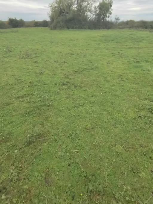
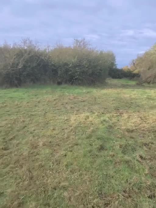
Field note: The south side of the chamber forms part of a field wall. A phone compass along that wall read about 282°, so if the chamber runs east–west as the 1972 record says, the entrance would face roughly east-south-east (an inference, not a measurement). The portal stones are overgrown, and a second wall 15–30 m away is most likely an old field boundary.
Read the full field journal. Photos: Garry Lohan, CC BY 4.0.
If you use the map, the horizons or the test results, please cite the project and the underlying open data (see Sources). The methods, data pipeline and pre-registration are written up on the results page.
Lohan, G. (2026). PA Réalt · Stone and Sky: Ireland’s Neolithic and Bronze Age monuments and the sky they face [Interactive map and pre-registered tests]. https://realt.skyoverstone.com/
@misc{lohan2026realt,
  author       = {Lohan, Garry},
  title        = {{PA R\'ealt} · Stone and Sky: Ireland's Neolithic and
                  Bronze Age monuments and the sky they face},
  year         = {2026},
  howpublished = {\url{https://realt.skyoverstone.com/}},
  note         = {Pre-registered tests T1--T5, code frozen at commit c244e8f.
                  Results: https://realt.skyoverstone.com/results.html}
}
Pre-registration frozen at commit c244e8f. Results: results page · Numbers: results file · Monument data: National Monuments Service SMR (CC BY 4.0) and NI SMR (OGL v3.0).
PA Réalt is a project by Garry Lohan (mechanical engineer and lecturer · Google Scholar · LinkedIn), about Irish monuments, astronomy and the Irish language. It is a sister site of PA Marine.
589 Republic monuments in these classes are not mapped because the NMS open data gives them no coordinates (ITM 0,0).
This is an independent research prototype, not an official National Monuments Service, OPW or Heritage Council product. Many sites are on private land: check access and respect the monuments. Rays and cards use each monument’s real horizon from the Copernicus 30 m surface model, which includes trees and buildings, so they are indicative only, not field surveys. The 15 Northern Ireland passage tombs use the OSNI 10 m photogrammetric DTM instead. That model is not LiDAR, so those horizons are not like for like with the Republic.
Research prototype by Garry Lohan. Alignments are computed, not field-surveyed. Not an official National Monuments Service product.

